Saturday, November 28, 2020

State Forest State Park


The curiously named State Forest State Park is about 2 hours west of us. Since we were not going anywhere for Thanksgiving, we decided to go camping.


The drive up the Poudre Canyon allowed us to see some of the devastation from the Cameron Peak fire, the largest fire in Colorado History. Many of the areas that we had hiked in the past were closed. 


 As we got close to Cameron Pass, the road became snowpacked. We went over the pass, past the Moose Visitor Center, and turned at the North Michigan Reservoir turnoff. I engaged the 4WD, due to the snowpacked roads. We had some trouble finding our campsite; we missed it the first time, and had to turn around. The campsite is very close to the dam. When we have stayed at the park in the past, we have been on the other side the reservoir, but that road is closed.


The moon rising over the mountains.


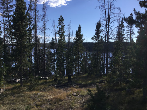
After we got the rig parked, we went for a hike on the beaver pond trail. The first part was nice, but then we got into an area that had been logged, with tree trunks blocking the trail, so we turned around.


As the evening went on, we watched the outside temperature go down. By 8 pm, it was 7 degrees outside. The furnace was running almost continuously.


In the morning it was -2 F, very cold. The camper continued to work, and it was not uncomfortable inside. However, the battery had dropped to 35% charge, having started the evening at 85% charge. When Richard started the generator, it was leaking gas a lot, so he shut it down. No way could we withstand another night of very cold weather without plugging in, or running a generator for a few hours. We stopped and asked about a campground where we could plug in, but no luck. We decided to take a hike and head home.


We drove to the end of the park road, and hiked on the North Canadian trail. The trail was packed down by tracked vehicles; when we went out of the track, we found somewhat difficult going, so we stayed on the track. The snow was not deep in most areas, except for north facing slopes. After hiking for an hour or so, we headed back to the camper, hooked up, and drove back to Fort Collins, getting home after dark.


We did learn some things. One is that if we are going to be camped in zero degree weather, the camper needs to be plugged in, or we need to plan to run the generator for several hours. The other is that the generator needs to be fixed or replaced. I bought the generator years ago, used, so it is perhaps 20 years old.


It was sunny, snowy, and beautiful. We will have to do it again.


Saturday, October 24, 2020

Canyonlands and Mineral Bottom


 On Thursday we packed up and left the commercial campground. We arrived at the BLM Horsethief campground around 10 AM, only to find no empty campsites. We talked to a couple who were about to leave, and ended up in their campsite. It is right next to the dirt road, but beggars can't be choosers.


After setting up the camper, we decided to go to Mineral Bottom, which turned into quite an adventure. Two young men had a shredded tire on their van, and their jack would not lift the van high enough to change the tire. We found out they were highliners, which we understand to be slackliners, but further off the ground. Between the truck jack and a wood block from the truck, Richard was able to lift it high enough to get the job done. They were surprised that several people stopped and asked if they needed help, even after we were already stopped.


Two of the switchbacks


Mineral bottom is 13 miles of dirt roads, to the edge of the cliff. The road goes over the edge and then back and forth along the side of the cliff, with occasional switchbacks. Sandi was scared to death. We made it down, and enjoyed the scenery along the banks of the Green River. 


After a lunch break, we decided to head south on the White Rim road, which follows the river. We drove a few miles, and turned around before we got into Canyonlands Park. As we were returning, we found four college age girls who had stuck their rental car in the sand. They were attempting to dig the wheels out with their flip flops and a frisbee! After reviewing our options, Richard decided that their best option was to jack up the front wheels, put rocks under them, and then wood and rocks behind them. Richard had a wood block to put under the base of the jack. Once we were ready, one girl drove and everyone else pushed. It worked! I am not sure that I recall rescuing two different groups in the same day, but Sandi said we did our kind thing for the day. Maybe for two days. We got back to the camper about 4, and rested before dinner.


Studying the weather forecast for Sunday, we saw that the weather service predicted a major storm and extreme cold. This caused us to rethink our trip plan. We decided to come home early, on Saturday, to beat the storm. In order to do this, we decided to start the drive on Friday, and finish it on Saturday.


Friday morning, we drove into Canyonlands NP, and headed for the southernmost part of the Island in the Sky section of the park. We decided to take the Grand View Point walk along the rim, looking down into the canyons of the Colorado and the Green Rivers. There were many people with the same idea; the views were impressive, and the hiking moderate, about 2 miles round trip. We had considered taking the walk to the Mesa Arch, but that parking lot was full, so we drove back to the camper, packed up, and headed out. We refueled in Grand Junction, and then continued on I-70 to the campground at Island Acres, part of the Colorado River State Park. The campground was pleasant and not crowded; we enjoyed a hike along the river.


Saturday we headed home. The closer we got to Fort Collins, the worse the smoke appeared. The two largest fires in Colorado history are west of us. Luckily the snow should put a damper on the fires.


Overall, a good trip. We plan to return in the future and hike more in Canyonlands. October is a busy month in that area, perhaps another month would be better.


Moab and Arches National Park


On Sunday October 18th we drove to Grand Junction, where we stayed at the RV Ranch. The drive on I-70 was routine, buying fuel in Arvada before we headed into the mountains.


On Monday we fueled up, and drove to Moab. Archview campground is north of Moab; we had a reservation for two nights, but were able to get that changed to three nights.


We drove through construction into Moab, and picked up lunch as Sultan's restaurant, which we ate in the town park. There were a lot of camper vans parked there, including people working on their laptops. We walked around downtown Moab, as Sandi had never been there before. Sandi did some shopping. Moab seems more upscale than in the past. The town was very busy, but we were told that October is their busiest month.


In the evening we drove into Arches National Park, which neither of us had seen before. It was very impressive and we took many photos. We plan to return in the morning.


Tuesday we got up very early, and were in the park before dawn. We took some photos of balanced rock at dawn, and took a short hike to see Delicate Arch, the symbol of Arches NP. Then we started to notice full parking lots. After that we stopped at the fiery Furnace, and continued to the end of the road. The area was closed, but we persuaded the ranger to let us through, so that we could check out the campground. The park was filling up, so we left. After a stop at the visitor center and bookstore, we left the park, and noticed that the entrance was closed, too many people. We drove over to check out Horsethief Campground, a BLM campground north of Canyonlands, and found a few empty sites. We also drove further down the dirt road, but the few campsites there were occupied. We did see some oil activity in that area. We continued into Canyonlands park, and stopped at the Green River overlook. We went back to the camper to rest, and later drove to the Windows area in Arches, where we were very impressed with the double arch, which is almost hard to believe. We left as it was getting dark.


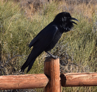
Every parking area seemed to have a noisy raven, begging.


Landscape Arch is almost hard to believe.


Wednesday we got up early, and were on the road by dawn. We drove to the Devil's garden area of the park, and hiked to Landscape arch. We stopped on the way to see Pine Tree Arch and Tunnel Arch. By the time we started back, the trail was getting busy, and the parking lot was full. We gave our parking space to a needy tourists, and headed for Moab. Sandi visited the local yarn shop. We had a pleasant lunch outdoors at the Arches Thai restaurant. We decided to drive the La Sal Mountain Loop Road, which starts along the Colorado River, and then climbs 5000 ft to 10,000 ft elevation. The road has more switchbacks that I could count, and many very steep sections. This was new for both of us. We checked out Ken's Lake Campground, south of Moab, on our way back to the campground. The weather forecast is forcing a trip replan, as we don't want to drive I-70 in the snow. We canceled our reservation for Sunday night in Grand Junction, but we may still spend a couple of nights in Grand Junction.


Friday, October 16, 2020

Backpacking in Rocky Mountain Park

 I had not been backpacking for a while, but decided to go on a short backpacking trip in Rocky Mountain National Park.   On Sunday, Sandi and I went to the park, got my wilderness permit, and took a hike.

Monday I drove to the Finch Lake trailhead, in the Wild Basin area, in the SE corner of the park.  The hike up was a grind.  My pack was 45 pounds.  The hike was 5 miles, about 1500 vertical feet up.  I found the official campsite, set up my tent, and cooked dinner.

Mt. Meeker in foreground, Longs peak left of Meeker

Tuesday I hiked and fished my way around the lake.  Unfortunately the fish had no interest in my Kastmaster lure, which usually works.   I am not 100% sure that I even saw fish dimpling on the water, so perhaps there were few fish in the lake, although the reports were of good fishing.     I was frustrated at first, but then settled down to enjoying the place.    The view of Longs and Meeker peaks from the other side of the lake was nice, kind of a unique view, as no roads will give you that view.


Camp Robber or Gray Jay


I had thought of hiking higher, but my boot was starting to come apart, so I did not.  With no fish and a bad boot, I ended up coming out Wednesday, a day early, after two nights, but I knew that was a possibility before I left.   It felt good to get out.  .


Thursday, September 24, 2020

Paddling the Niobrara River, and Smith Falls


On Saturday, after organizing a bit and moving some boats around, we headed for the put in at the Fort Niobrara Wildlife refuge. We got on the water about 10 AM, with eleven people and seven boats. We took a brief hike to Fort Falls, and when we got back to our boats, we saw a lady in her kayak, towing a submerged kayak. Richard headed over to help, and we were able to get most of the water out. We took the kayak to shore. The occupant of the kayak was walking on the shore, but was on the opposite side of the river. We took a canoe over to ferry him across the river. They paddled with us for a while.


Fort Falls


We continued paddling until we found a lunch spot. We conti­nued on, with the winds increasing. The river is pretty and shallow in many places, with a rock bottom in the shallow spots. When we got to Smith Falls, we pulled the boats out of the water, and ran the drivers back to the put in. We announced we would serve ice cream at 7 PM, and everyone showed up. We had a nice group and some nice conversation.


On Sunday, we dropped some vehicles at Sunnybrook camp, and then came back to Smith Falls to start our paddle. The paddle was scenic; we had a bit of rain in the morning, and sun in the afternoon. We had lunch on a sand bar. We saw osprey, a great blue heron, a group of buzzards in a tree, and a bald eagle. We got off the river about three PM. We again had ice cream at 7; Kit bought wood for a fire. We swapped stories around the fire until 9 PM.


Monday we slept in, and drove to the Fur Trade Museum in Chadron, the best museum of its kind in the world.  We then headed for Chadron State Park.  The park looked nice, but we had some trouble finding a campsite that our rig would fit into; the campground host was nice and helped us find a spot.  Tuesday we drove home, using a Circle Tours booklet, which described the points of interest.   We stopped in Dalton at the Round Robin bar, with an early junkyard decor.  We saw Courthouse Rock and Jailhouse Rock,  and made a stop in Potter at the Tin Roof Soda Fountain.  The folks in Potter are working hard to make their town attractive and fun; Dalton was kind of dead, but had an old fire truck for sale.


Fort Robinson and Northwest Nebraska


On Sunday, we drove about 200 miles to Fort Robinson State Park. Google took us through the wilds of eastern Wyoming, including quite a bit of gravel road.


We arrived in Fort Robinson without reservations, but were able to get a full hookup site. Fort Robinson was built in the late 1800s, and used by the military until after World War II. It became a state park in the 1950s. Normally they would offer trail rides and a swimming pool, but all activities were canceled due to Covid. We walked around the grounds, which contain numerous old buildings now converted to lodging. We were told that it is very popular for family reunions, and we can see why.


Richard had printed road trips from DiscoverNebraska.com. On Monday, we decided to take the longest of the road trips, largely on gravel or dirt roads. Our first stop was at the Cheyenne Outbreak monument, commemorating when the Indians at Fort Robinson broke out and tried to go back to their homeland. The fighting killed 70 Indians and 11 soldiers, but ultimately the survivors were taken back to Fort Robinson. We then went north to Sowbelly Canyon. The name came from an Indian ambush that left the soldiers trapped with nothing to eat but sow bellies; they escaped after several days. This was very picturesque, with a small stream running down it, and cliffs on both sides. We stopped at Coffey Park for a picnic, a very pleasant spot. 


 We turned north near Harrison, and headed into the Oglala National Grassland. This is ranch country, and ranch homes are very far apart. We turned east, and stopped at the church and cemetery in Montrose. The only house in Montrose was falling down, but the church of the Immaculate Conception was in very good condition. The church was open, and we went in. We also walked around the cemetery. Across from the church was the Warbonnet Battlefield, where the 5th Cavalry stopped a large group of Cheyenne who were attempting to link up with Sitting Bull. The only casualty of the battle was the Cheyenne Yellow Hair, killed and scalped by Buffalo Bill Cody, who was a scout for the military.

Our next stop was Toadstool Geological Park. We took a one mile hike through the badlands area. The toadstools are not as impressive as those of Goblin State Park in Utah. We continued on Toadstool road until we reached the paved road north of Crawford. We got back to our camper around 5 PM, after stopping at the gas station liquor store for beer.


It was a lot of driving on dirt and gravel roads, and tiring. We resolved not to go as far on the next day. Sandy cooked pork chops for dinner.


Death of Crazy Horse

Tuesday was laid back; it was too hot to hike. In the morning we went to the museum, which covered the long history of the fort. Crazy Horse was killed here. The fort was repurposed multiple times, including as remount facility for training Army horses, and a German POW camp in WWII. The black Buffalo Soldiers were here. In the afternoon we followed the White River Road along the White River, which paralleled the old Chicago and Northwestern railroad grade. We stopped at the Glenhaven cemetery, with many graves from the early 1900s. We saw antelope and turkeys, in a pretty valley. Sandi cooked shrimp kabobs for dinner.


On Wednesday, the weather was cool, so we went for a hike. We drove up the Smiley Canyon road, and saw the herd of bison. The road was blocked by a herd of horses, who may have been hoping for a handout. We pulled forward slowly until the horses moved out of the way; some of them may have gotten bumped by the truck. The Turtle Rock trail goes from the Smiley Canyon road to the top of the cliffs overlooking the valley, and back again. It was a steady climb, with some nice views.


We decided to drive to the town of Harrison to have lunch, as there were no picnic areas off the Smiley Canyon road. After lunch, we noticed that the historical museum was open, and decided to take a look. The cattle brand display in the window drew our attention; the barb wire collection was excellent. Our guide was a retired school teacher, who had taught at one room school houses. We learned that Sioux county still had two one room schools. The Harrison Hotel, built in 1886 as a railroad hotel, is still open. We took a little tour. Sandi cooked bison burgers for dinner. ;-)


On Thursday, we had hoped to do some hiking, but the smoke was bad. In the morning, we visited the sites of the Red Cloud Indian Agency, and the German POW Camp. We also stopped at the museum bookstore to pick up some gifts. After a lengthy nap by Richard, we drove to the Council Tree, the site of a large council in 1875, during which the US government attempted to buy the Black Hills from the Indians. We also drove up Soldier Creek, to the end of the road, and found the small primitive campground there.


On Friday, we decided to visit the Crawford Livestock Market. We pulled our rig next to the stock trailers and chatted with a cowboy named Ferguson, who went to the University of Nebraska at Lincoln, “East Campus.” Richard took some photos of the cattle being moved. Sandi did her best “Hi y'all”, and mentioned that she had grown up on a farm. We did get some heckling, and people asking us why we were there. They sell thousands of cattle per week.


We drove east to Smith Falls State Park, stopped in Valentine for provisions, and managed to make a wrong turn. We got there about 6 PM, after losing an hour for the time change. Our group started to show up, and we met some folks. The campsites were huge, but no utilities. The park has bathrooms and pay showers.


Thursday, August 20, 2020

Fleeing the Apocalypse


We had been reading about fires in Colorado. We had a campsite reserved up the Poudre Canyon, at Chamber's Lake, near the top of Cameron Pass. A few days before we were to leave, we learned about a major fire near Chambers Lake, called the Cameron Peak fire. Our campsite reservation was canceled by the Forest Service. We had to make a decision.


The night before we were to leave, the dark cloud from the fire was high over Fort Collins, looking very ominous. The sun was blood red, adding to our unease. We knew that there were multiple major fires in Colorado, and considered where we should go.


Since the Poudre Canyon road, and most of its campsites, were closed, we decided to head west by going north, through Laramie Wyoming, and then go to Teal Lake Campground, southwest of Walden Colorado.


On the morning of our departure, the smoke was very bad, causing us to cough. We desperately wanted to escape the smoke, to flee the Apocalypse. The smoke cleared as we headed up US287 to Laramie. Outside Laramie, the skies were clear, but we could see pollution in the Laramie Valley. We refueled in Laramie, and considered our options. Our backup plan was to head for the Wyoming Snowy Range mountains. As we looked west, the choice seemed clear; turn south towards Colorado and dense smoke, or turn north towards the Snowy Range, which was clear.    We decided to head for Rob Roy Reservoir, which we had never seen. We drove through the tiny town of Albany, population 55, with a fire station and one business, and headed uphill on washboard dirt roads. Everything was jolted by the washboards. Eventually, we arrived at Rob Roy, and were glad to be in clear skies. There were plenty of campsites, perhaps due to it being Sunday afternoon, and due to the bad road. We chose a campsite overlooking the lake, with a good number of trees, and were happy to be there. The campground was somewhat primitive, with hand pumps for water.


The lake is popular for fishing for Kokanee Salmon, but one needs a boat, which we did not bring. We saw a few boats tied up to shore. We planned to fish for trout from shore. We had bought two day Wyoming fishing licenses, starting Monday.


Looking to the south, we could see smoke, but there is no smoke here to speak of. The air is a bit thin, at 9500 ft elevation.


On Monday morning, Richard went out and fished for a couple of hours, but only foul hooked a small fish. Sandi communed with the chipmunks and ground squirrels, and studied her “Field Guide to the Rocky Mountain States.” Midday, we took a driving tour around the lake to Keystone, an old mining town, now with summer cottages. We saw an impressive bull moose in Keystone.

Sandi cooked shrimp for dinner, and we went back to the lake to practice fishing. Richard caught a small trout. Morning and evening, there was a lot of feeding on the surface, but they outsmarted us.


Tuesday, we fished in the morning, no luck. We took a drive to the Spruce Mountain fire lookout tower. We thought that it would be a hike, but we could drive almost to the base of the tower. They apparently take reservations to stay overnight. Richard could walk up the stairs almost to the top, where he had a good view of Medicine Bow peak. We wandered further to Cinnabar Park, a large meadow, where a few RVs with ATVs were camped. We walked over to a cross dedicated to Joyce and Fred, next to one of the only trees in the area, probably planted by their family. We got back and had salmon for dinner. Richard fished for an hour, and had one good fish on, but the fish jumped out of the water and got off. The skies were very cloudy, so our star watching plan will have to wait for another day.


Wednesday we decided to try to move to one of the campgrounds off the Snowy Mountain Scenic Byway road. We had lunch outside at the Beartree Tavern and Restaurant, in Centennial Wyoming; the patrons outside outnumbered the ones inside.  The town of Centennial is a funky place.


 The views from the Snowy Range Road were great, very alpine, but the trailheads were crowded, and there were no campsites to be had, even on a Wednesday. The license plates were mostly Colorado. We decided to go home a day early.

Friday, July 31, 2020

Paddling the Smith River

Debbie in front, picking the best line

Five of us headed for the Smith River in Montana to paddle the Smith River.   The trip had been in doubt due to concerns about low water, but rain made the trip possible.

I drove up to Tongue River State Park in Montana, where I joined Debbie and Tim for the evening.   The next day I drove to Billings, where I picked up my fishing license.   We all met in the Conestoga Campground in White Sulphur Springs.   Don and Sonia drove up in one day.  Randy had been meandering his way northeast from Arkansas, including Yellowstone National Park.  

Thanks Debbie for this photo
Randy and I in front.  
Thanks to Debbie for this picture.

On July 25th, we drove to Camp Baker to put in.  The Ranger gave us his talk and tags for our boat.   I struggled some with organization, not atypical for a first day on the river.    The river was low, 200 cfs, and we dragged a fair amount.  We paddled 12 miles to Upper Scotty Allen camp.  The night was cold.

One of the many bald eagles we saw


Randy in camp.
Note the electric bear fence in the background.
Day two on the river we went 12 miles to Upper Sunset Cliff Camp.   There was more water after Tenderfoot Creek entered, and the dragging from that point was not bad.  We saw a marmot, several deer, and two snakes.   We did have quite a few bugs, the only night we had that problem.  Randy caught a couple of trout.   We took a short hike to the top of a cliff for the view. 


Day three we went 14 miles to Parker Flat #1.  We saw many bald eagles.   Don swam often, as he did almost every day.   Sonia and Don moved their tent after seeing a rattlesnake.    We continued to have beautiful weather, with minimal wind. 


Thanks Sonia for this photo

Day four we hiked up to the cave with pictographs.  It was a steep climb with poison ivy, but the view was good, and the pictographs were interesting.   We saw a bear cub above camp, and a deer and two fauns in camp.  We went 7 miles to Lower Ridgetop camp.   


Day five we paddled 15 miles through ranch land to the Eden Bridge takeout.  I headed for home, and overnighted in Big Timber.   

The drive home from Big Timber was uneventful, although 560 miles is a longer day than I typically drive.

Overall, an excellent trip, good folks, good weather, and a beautiful river.

Sunday, June 21, 2020

Poudre Canyon - Covid summer, chapter 1


In early June, Sandi and I drove up the Poudre Canyon to scout campgrounds. At Kelly Flats, next to the Poudre River, the campground host suggested that we show up Wednesday morning if we wanted a campsite, as it is first come first served. It has been a busy summer in the Poudre Canyon campgrounds, so it takes strategy to get a good campsite. The campgrounds just opened June 1st, and people have been feeling cooped up and wanted to get out.

On June 17th, we drove to Kelly Flats campground, and spoke to the campground host. She told us who was leaving that day, and we chose one of those sites. We waited an hour or so before they left. The campsite was right next to the river, at the end of a cul-de-sac, so an excellent campsite.


We decided to head up the canyon, and stopped at Glen Echo Resort, where we had hamburgers outside. We continued up the canyon to Long Draw Road, where we hoped to drive up and find the trailhead to the ghost town of Lulu. However, the road was gated closed, so that was not going to work. We instead walked on the Blue Lake Trail. We did not walk all the way to Blue Lake, but we did get some views of Chamber's Reservoir. The creeks and rivers are running high. The photo of Sandi was taken at one of the creeks; I was experimenting with longer exposures to get artistic photos of water.

Small Rainbow Trout
On Thursday the 18th, we headed up to Chamber's lake to go fishing. When we parked, the map showed a smaller lake nearby, called Lost Lake. We took a short hike to Lost Lake. Sandi practiced with her new rod and reel. Richard caught and released a couple of small rainbow trout. It was cold, so we knocked off after a couple of hours, and headed back down to the camper. We worked on our relaxing. Sandi cooked salmon for dinner.


Friday the 19th, we again headed for Chamber's Lake. This time we walked past the closed gate, to the campground. We started to fish, but the thunder got closer, so we headed for the only available shelter, the porch of the campground pit toilet.
We saw rain and sleet, and were glad to be out of the weather, while we ate lunch. After the rain stopped, we resumed fishing. Richard caught and released about five 8 inch rainbow trout. Sandi continued practicing, and had a couple of nibbles. We scouted the campground for future reference, and saw that it was very good. We walked back to the truck, and headed down the canyon, taking a photo at Poudre falls. We stopped at Archer's resort, which had a little of everything, including the fishing lure that I was looking for; Archer's is similar to Glen Echo, but with lower gas prices.

Sandi grilled Italian sausage outside; the leftovers will be used as part of a pasta dinner on Saturday.

Columbine - Colorado State Flower

There are about twenty butterflies in this photo.

On Saturday we took a hike up Dadd Gulch. The trail follows the small stream. There were literally hundreds of butterflies near the stream, I am only including two photos out of many that I took. The columbines were also gorgeous. The hike was pleasant but warm. There were quite a few parties on the trail, as this is not far from Fort Collins. Saturday night we had a campfire.

Sunday we got up early so we would not miss our ancient Greek class, via Zoom.